

Where there’s smoke, there will be no fire because a drone is already on the scene. At least that’s the hope of Zhaodan Kong, Professor in the Department of Mechanical and Aerospace Engineering, and his team at the University of California, Davis.
The group is working on a proactive solution to fighting the brutal California wildfires, as the current method gets firefighters to the scene too late. It’s an integrated system of technologies used to detect fires before they get to a heavy smoking point.
“Our solution consists of two main parts: early fire risk prediction and early fire detection and tracking,” Kong said. “We are focusing on early detection and tracking because we believe early detection often leads to a smaller fire size at the initial attack, a greater probability of containment, and the prevention of loss of life and property.”
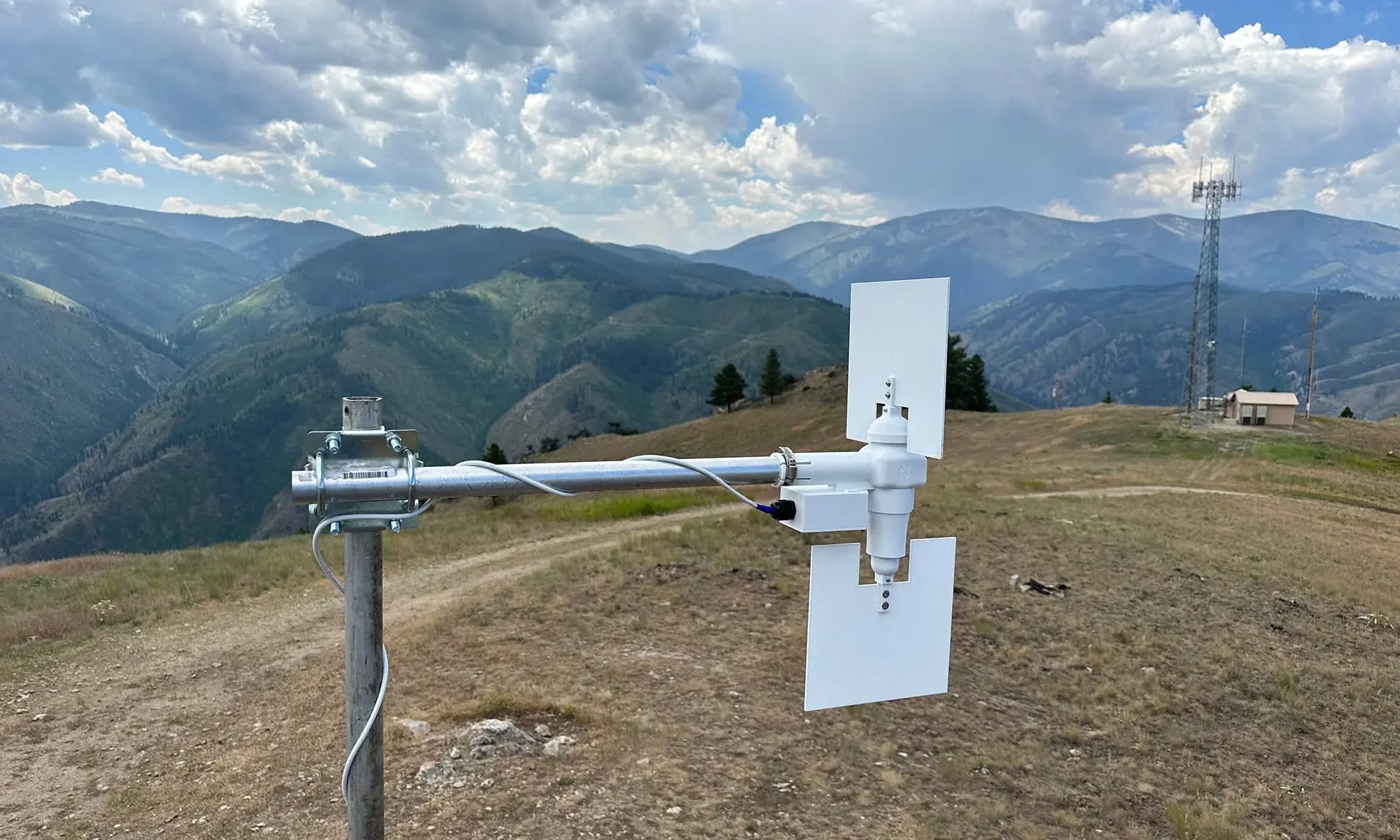
Kong said the detection would start on the ground via internet-connected sensors placed in CalFire-determined areas of danger. Palm-sized and developed by UC Davis’ Anthony Wexler, the sensors measure temperature, humidity, and wind speed — the necessary ingredients for a wildfire, according to Wexler.
For reconnaissance missions, the team is building a rotorcraft equipped with navigation systems, sensors, and cameras. “We have completed our design and prototyping, and we are in the process of building and testing it. It has a biplane-multirotor configuration,” Kong said.
The fire risk prediction model is built based on historical data on weather, fuel, such as vegetation, topography, and fire, Kong said. Such a model can be trained using machine learning. Then, it can be deployed in real-time by feeding real-time information about weather, provided by the ground sensors, fuel, and topography, GIS data, he added.
The latter model can only identify high-fire-risk areas. The team can then use its fire detection and tracking module to patrol and search for potential fires. The module mainly consists of a group of uncrewed aerial vehicles (UAVs), each equipped with multiple sensors, including electronic-optical (EO) and infrared (IR) cameras, chemical sensors, wind sensors, and multispectral cameras.
EO/IR/chemical sensors work together to detect fire from a location that might be far away from the fire; wind sensors are needed since wind is one important driver of fire and the wind field is not uniform, e.g., wind speeds and directions can be quite different across a mountain ridge; and multispectral cameras can be used to provide high-resolution vegetation information if needed, GIS data can be outdated and normally with a low resolution, Kong said.
“A group of such UAVs will be deployed since that will increase the efficiency of localizing potential fires,” Kong said. “Once a fire and/or smoke has been identified by our EO/IR cameras or a chemical indicative of wildfire has been identified by our chemical sensors, the UAV group will switch to tracking mode. They can, for example, use the plume and the onboard sensors to trace back to the resource — working like K9 dogs,” he added.
How much sooner could this method detect a blaze than current methods? Well, that depends on the location of the ignition point.
“The Dixie Fire was the largest and most destructive fire of the 2021 California wildfire season and the most expensive — measured by the cost of the firefighting effort — wildfire in U.S. history,” Kong said. “The ignition was around 7 a.m.; the fire became visible from Highway 70 in the late afternoon, which prompted multiple reports to 911; and fire engines and air tankers were in place around 5 p.m.”
According to Kong, their method can significantly cut the detection time, “If one of our UAVs were near the ignition, it should have detected the fire within minutes, but they need to be at the right place and at the right time. That is why we are taking a proactive approach to prioritize areas of high risk. I can’t provide a specific number, but we discovered that, on average, chemical sensors can detect a fire earlier than EO/IR cameras.”
Kong said the team has begun testing its ground sensors in Quail Ridge Reserve, a natural reserve managed by UC Davis. The main goal is to showcase that the inexpensive sensors can sustain harsh conditions in rugged terrain. They installed five last November; one was damaged due to a flood, but the other four are still functioning.
This article was written by Andrew Corselli, Digital Content Editor at SAE Media Group. For more information, visit here .