
Originating Technology/NASA Contribution
NASA not only peers up to gather information about space; it also peers down to gather information about Earth. As part of the Science Mission Directorate, NASA’s Earth Science Program aims to improve predictions about climate, weather, and natural hazards by understanding Earth’s response to natural and human-induced changes. One way scientists are tracking these changes is by monitoring the Earth’s soil moisture and ocean salinity.
As part of the water cycle, soil moisture and ocean salinity are interconnected with Earth’s energy and biogeochemical cycles (carbon, nitrogen, and others). Together, these natural cycles play a role in moderating the overall environment. For example, ice can melt into the ocean to dilute ocean salinity, which affects ocean circulation, which affects an area’s climate.
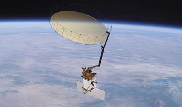
In 2015, NASA plans to embark on a mission called Soil Moisture Active and Passive (SMAP) to provide global measurements of soil moisture and its freeze and thaw states. Measurements from the SMAP spacecraft will lead to a better understanding of the processes that link the water, energy, and carbon cycles, and will significantly inform Earth system science, water resource assessment, and natural hazards mitigation.
The best way to measure surface conditions such as soil moisture and ocean salinity is through microwave remote sensing at long wavelengths, such as at L-band. However, receiving long wavelengths from Earth requires large antennas in space. To prepare for microwave remote sensing at long wavelengths, NASA has supported the development of smaller, lighter, more compact devices to uncover fluctuations in soil moisture and ocean salinity.
Partnership
As a result of Small Business Innovation Research (SBIR) funding from Goddard Space Flight Center in 2000, ProSensing Inc. , of Amherst, Massachusetts, developed a compact, ultrastable radiometer for sea surface salinity and soil moisture mapping. Taking advantage of the rapid advances in telecommunications at the time, ProSensing incorporated small, low-cost, high-performance elements into just a few circuit boards. By using two or more radiometers (called arraying) and combining the signals they receive, the radiometers act as small pieces of one large system.
“It was important to make them small enough to hold in the palm of your hand. Previous radiometers were about 10 times the size. If we built radiometers the old way, it would take a lot more time, money, and effort. By using cell phone technology, it cost 50-percent less and gave us a competitive advantage,” says James Mead, president of ProSensing.
By 2005, ProSensing had delivered 35 units to Goddard for use in a research instrument called 2D-STAR (Two Dimensional Steered Thin Array Radiometer). Flown on an aircraft, 2D-STAR was developed to demonstrate interferometric technology (arraying radiometers to act as one large radiometer) for remote sensing of soil moisture.
David M. Le Vine, a scientist at Goddard Space Flight Center, says, “2D-STAR achieves the results of a large antenna without putting a massive structure in space. We were able to show the technology could work from airplanes, with the idea of going from airplanes to space.”
Product Outcome
During its work with Goddard, ProSensing received a request from the University of Melbourne, Australia, to build six ultrastable radiometer modules for airborne remote sensing at a new facility being developed through the support of the Australian Research Council, University of Melbourne, University of Newcastle, James Cook University, and Airborne Research Australia at Flinders University. By 2006, ProSensing had built and delivered a polarimetric L-band microwave radiometer (PLMR) using the radiometer modules.
According to the University of Melbourne, PLMR enables mapping in unprecedented detail of soil moisture, land surface salinity and temperature, and ocean surface salinity and temperature. The University appreciates the instrument’s small size, light weight, and affordability.
Based on the advances made possible by working with NASA, ProSensing offers two lightweight radiometers for mapping soil moisture, ocean salinity, and wind speed: the PLMR and the Scanning Low Frequency Microwave Radiometer. ProSensing’s customers include government research agencies, university research groups, and large corporations in North America, Europe, and Asia.

The way a microwave radiometer works is by measuring natural radiation. In the case of the ocean, the amount of signal that is radiated changes with salinity. The parameter used to describe this is called the emissivity of the surface. In the case of soil, the emissivity changes with moisture. Additionally, the emissivity depends on how rough a surface is, and this is why a radiometer can also measure wind speed over the ocean. The faster the wind blows, the rougher the surface gets, resulting in more signals being transmitted to the radiometer.
In 2008, the NASA-derived technology influenced the design and development of a hurricane imaging radiometer (HIRAD) to measure ocean wind speed in hurricanes. The instrument, under development at Marshall Space Flight Center, uses the same technique as the ultrastable radiometer, but operates at a different wavelength.

HIRAD is a compact, lightweight, low-power instrument that produces imagery from an aircraft or spacecraft. Specifically, Marshall is developing HIRAD to measure ocean surface wind speed from hurricane reconnaissance aircraft with fine spatial resolution over a wide angular swath. ProSensing delivered 12 single-board, four channel radiometer receivers to Marshall, which are now being integrated into HIRAD.
In 2009, ProSensing received a contract from one of the largest research centers in Germany, the Institute of Chemistry and Dynamics of the Geosphere, to build a copy of the PLMR. Requiring six ultrastable radiometer modules, the Institute uses PLMR for research measurements of soil moisture and salinity.
Most recently, the University of Massachusetts requested two radiometer modules from ProSensing to test their applicability for noninvasive readings of cerebrospinal fluid temperature (temperature of the fluid that circulates around and through the brain and spinal cord). Usually, a spinal tap is used for this procedure to diagnose certain neurologic disorders, particularly infections like meningitis. “If you can take temperature remotely with a radiometer and see that it is elevated, then this could have wide application in emergency rooms,” says Mead.
Mead says many projects have grown out of the NASA SBIR program over the years. “NASA had a long-term interest in developing the technology and was eager to take what we built and put it to use. That gave us something to design to. Now we have some fairly mature projects, and some that are just getting kicked off.”