42
61
169
-1
840
30
Briefs: Software
ASCENT Program
The ASCENT program solves the three-dimensional motion and attendant structural loading on a flexible vehicle incorporating, optionally, an active analog thrust control system, aerodynamic effects, and staging of multiple bodies.
Briefs: Software
JPL Genesis and Rapid Intensification Processes (GRIP) Portal
Satellite observations can play a very important role in airborne field campaigns, since they provide a comprehensive description of the environment that is essential for the experiment design, flight planning, and post-experiment scientific data analysis. In the past, it has been...
Briefs: Software
Data::Downloader
Downloading and organizing large amounts of files is challenging, and often done using ad hoc methods. This software is capable of downloading and organizing files as an OpenSearch client. It can subscribe to RSS (Really Simple Syndication) feeds and Atom feeds containing arbitrary metadata, and maintains a local content...
Briefs: Software
Fault Tolerance Middleware for a Multi-Core System
Fault Tolerance Middleware (FTM) provides a framework to run on a dedicated core of a multi-core system and handles detection of single-event upsets (SEUs), and the responses to those SEUs, occurring in an application running on multiple cores of the processor.This software was written expressly...
Briefs: Software
DspaceOgreTerrain 3D Terrain Visualization Tool
DspaceOgreTerrain is an extension to the DspaceOgre 3D visualization tool that supports real-time visualization of various terrain types, including digital elevation maps, planets, and meshes. DspaceOgreTerrain supports creating 3D representations of terrains and placing them in a scene graph. The 3D...
Briefs: Information Technology
Trick Simulation Environment 07
The Trick Simulation Environment is a generic simulation toolkit used for constructing and running simulations. This release includes a Monte Carlo analysis simulation framework and a data analysis package. It produces all auto documentation in XML. Also, the software is capable of inserting a malfunction at any...
Briefs: Software
Water Detection Based on Color Variation
This software has been designed to detect water bodies that are out in the open on cross-country terrain at close range (out to 30 meters), using imagery acquired from a stereo pair of color cameras mounted on a terrestrial, unmanned ground vehicle (UGV). This detector exploits the fact that the color...
Briefs: Information Technology
Geometric Reasoning for Automated Planning
An important aspect of mission planning for NASA’s operation of the International Space Station is the allocation and management of space for supplies and equipment. The Stowage, Configuration Analysis, and Operations Planning teams collaborate to perform the bulk of that planning. A Geometric Reasoning...
Briefs: Software
Software to Control and Monitor Gas Streams
This software package interfaces with various gas stream devices such as pressure transducers, flow meters, flow controllers, valves, and analyzers such as a mass spectrometer. The software provides excellent user interfacing with various windows that provide time-domain graphs, valve state buttons,...
Briefs: Software
Histogrammatic Method for Determining Relative Abundance of Input Gas Pulse
To satisfy the Major Constituents Analysis (MCA) requirements for the Vehicle Cabin Atmosphere Monitor (VCAM), this software analyzes the relative abundance ratios for N2, O2, Ar, and CO2 as a function of time and constructs their best-estimate mean. A histogram is first...
Briefs: Software
Predictive Sea State Estimation for Automated Ride Control and Handling — PSSEARCH
PSSEARCH provides predictive sea state estimation, coupled with closedloop feedback control for automated ride control. It enables a manned or unmanned watercraft to determine the 3D map and sea state conditions in its vicinity in real time. Adaptive path-planning/...
Briefs: Software
LEGION: Lightweight Expandable Group of Independently Operating Nodes
LEGION is a lightweight C-language software library that enables distributed asynchronous data processing with a loosely coupled set of compute nodes. Loosely coupled means that a node can offer itself in service to a larger task at any time and can withdraw itself from service...
Briefs: Software
Real-Time Projection to Verify Plan Success During Execution
The Mission Data System provides a framework for modeling complex systems in terms of system behaviors and goals that express intent. Complex activity plans can be represented as goal networks that express the coordination of goals on different state variables of the system. Real-time...
Briefs: Software
Automated Performance Characterization of DSN System Frequency Stability Using Spacecraft Tracking Data
This software provides an automated capability to measure and qualify the frequency stability performance of the Deep Space Network (DSN) ground system, using daily spacecraft tracking data. The results help to verify if the DSN performance is...
Briefs: Software
Web-Based Customizable Viewer for Mars Network Overflight Opportunities
This software displays a full summary of information regarding the overflight opportunities between any set of lander and orbiter pairs that the user has access to view. The information display can be customized, allowing the user to choose which fields to view/hide and filter.
Briefs: Software
Dispersed Fringe Sensing Analysis — DFSA
Dispersed Fringe Sensing (DFS) is a technique for measuring and phasing segmented telescope mirrors using a dispersed broadband light image. DFS is capable of breaking the monochromatic light ambiguity, measuring ab solute piston errors between segments of large segmented primary mirrors to tens of...
Briefs: Software
'In Situ' Mosaic Brightness Correction
In situ missions typically have pointable, mast-mounted cameras, which are capable of taking panoramic mosaics comprised of many individual frames. These frames are mosaicked together. While the mosaic software applies radiometric correction to the images, in many cases brightness/contrast seams still exist...
Briefs: Software
Simplex GPS and InSAR Inversion Software
Changes in the shape of the Earth’s surface can be routinely measured with precisions better than centimeters. Processes below the surface often drive these changes and as a result, investigators require models with inversion methods to characterize the sources. Simplex inverts any combination of GPS...
Briefs: Software
Virtual Machine Language 2.1
VML (Virtual Machine Language) is an advanced computing environment that allows spacecraft to operate using mechanisms ranging from simple, timeoriented sequencing to advanced, multicomponent reactive systems.
Briefs: Software
Multi-Scale Three- Dimensional Variational Data Assimilation System for Coastal Ocean Prediction
A multi-scale three-dimensional variational data assimilation system (MS-3DVAR) has been formulated and the associated software system has been developed for improving high-resolution coastal ocean prediction. This system helps improve coastal ocean...
Briefs: Software
Pandora Operation and Analysis Software
Pandora Operation and Analysis Software controls the Pandora Sun- and sky-pointing optical head and built-in filter wheels (neutral density, UV bandpass, polarization filters, and opaque). The software also controls the attached spectrometer exposure time and thermoelectric cooler to maintain the spectrometer...
Briefs: Software
Doppler Lidar Signal Processing Suite (DLiSPS)
DLiSPS is a collection of software modules that processes lidar data and displays/archives the output products. It has the same features as the real-time version written in C++, except the hardware control capability, with many other functionalities for off-line lidar signal processing. DLiSPS is...
Briefs: Software
3D Visualization for Phoenix Mars Lander Science Operations
Planetary surface exploration missions present considerable operational challenges in the form of substantial communication delays, limited communication windows, and limited communication bandwidth. A 3D visualization software was developed and delivered to the 2008 Phoenix Mars Lander...
Briefs: Software
System-of-Systems Technology-Portfolio- Analysis Tool
Advanced Technology Life-cycle Analysis System (ATLAS) is a system-of-systems technology-portfolio-analysis software tool. ATLAS affords capabilities to (1) compare estimates of the mass and cost of an engineering system based on competing technological concepts; (2) estimate life-cycle costs of...
Briefs: Software
VESGEN Software for Mapping and Quantification of Vascular Regulators
VESsel GENeration (VESGEN) Analysis is an automated software that maps and quantifies effects of vascular regulators on vascular morphology by analyzing important vessel parameters. Quantification parameters include vessel diameter, length, branch points, density, and fractal...
Briefs: Software
Constructing a Database From Multiple 2D Images for Camera Pose Estimation and Robot Localization
The LMDB (Landmark Database) Builder software identifies persistent image features (“landmarks”) in a scene viewed multiple times and precisely estimates the landmarks’ 3D world positions. The software receives as input multiple 2D images of...
Briefs: Software
Adaption of G-TAG Software for Validating Touch and Go Asteroid Sample Return Design Methodology
A software tool is used to demonstrate the feasibility of Touch and Go (TAG) sampling for Asteroid Sample Return missions. TAG is a concept whereby a spacecraft is in contact with the surface of a small body, such as a comet or asteroid, for a few...
Briefs: Software
Techniques for Down-Sampling a Measured Surface Height Map for Model Validation
This software allows one to down-sample a measured surface map for model validation, not only without introducing any re-sampling errors, but also eliminating the existing measurement noise and measurement errors.
Briefs: Test & Measurement
Nemesis Autonomous Test System
A generalized framework has been developed for systems validation that can be applied to both traditional and autonomous systems. The framework consists of an automated test case generation and execution system called Nemesis that rapidly and thoroughly identifies flaws or vulnerabilities within a system. By applying...
Top Stories
 Blog: Power
My Opinion: We Need More Power Soon — Is Nuclear the Answer?
 Blog: AR/AI
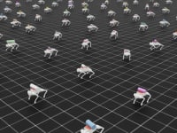
Aerial Microrobots That Can Match a Bumblebee's Speed
 News: Energy
 Blog: Electronics & Computers
Turning Edible Fungi into Organic Memristors
 Blog: Robotics, Automation & Control
Microscopic Swimming Machines that Can Sense, Respond to Surroundings
 INSIDER: Sensors/Data Acquisition
Webcasts
 Upcoming Webinars: Automotive
Hydrogen Engines Are Heating Up for Heavy Duty
 Upcoming Webinars: Transportation
Advantages of Smart Power Distribution Unit Design for Automotive...
 Upcoming Webinars: Transportation
Quiet, Please: NVH Improvement Opportunities in the Early Design...
 Upcoming Webinars: Sensors/Data Acquisition
From Spreadsheets to Insights: Fast Data Analysis Without Complex...
 Upcoming Webinars: Test & Measurement
Battery Abuse Testing: Pushing to Failure