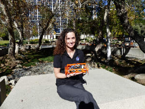
A geologist by training, Carolyn Parcheta had an idea in July of 2013 to develop a robot that explores and measures the shape of volcanic fissures. She worked with engineering teams at JPL to develop the VolcanoBot. In May 2014, the robot explored Mauna Ulu on Kilauea’s East Rift Zone in Hawaii. A smaller, more compact version, VolcanoBot 2, will return early this month.

NASA Tech Briefs: Why are robots an effective way to explore volcanoes?
Carolyn Parcheta: They can help scientists get into places that are too dangerous to otherwise take data. In this particular case, it’s not only dangerous; a lot of these fissures are too skinny for a human to fit into. They’re long and deep, but they’re just too thin.
NTB: With some of these fissure walls being a foot across, how is the robot designed to fit?
Parcheta: We designed the robot to have half-foot-diameter wheels initially. The robot is now down to 4.5"-diameter wheels. The sensors ride along the axle inside a 3D-printed harness. There is a tail on the back side of the robot attached to a tether, and this helps to keep VolcanoBot facing downward in the fissure as it rolls along one of the walls. I picked the axle-style design in order to let the robot roll down either wall of the fissure. There was a possibility (which we confirmed) that the angle of the fissure into the ground reversed.
NTB: Can you take me through the first Hawaii field test?
Parcheta: The first test was five days long and started with testing VolcanoBot on the edge of a fissure, where we could still reach it and help it if needed. Once we got a feel for how the robot would perform when it would be out of our reach, we decided to make the first descent. We spent the first afternoon and the second day of the field test imaging one of 54 vents along the fissure. The vent is 8 meters long and 0.5 - 0.75 meters wide. Our third day involved some reconnaissance and testing at a lava tube on neighboring Mauna Loa’s southwest rift zone, and then we went back to Mauna Ulu for two days to partially map three other vents along the fissure and a nearby crack that looks similar to the fissure, but did not erupt lava.
NTB: Why is this work so important?
Parcheta: We are, for the first time ever, documenting essentially the conduit of a volcano, or a volcanic eruption. Knowing that geometry and the shape of the pathway allows us to understand the fluid dynamics of the eruption better. Once we understand that, we can more accurately understand the hazards on the surface and what’s causing those hazards.
We can also take that technology and apply it to potential volcanic fissures on Mars or the Moon that look similar to terrestrial fissures, but we’re not quite sure if they are or not. Eventually, it could even go to [moons like] Europa or Enceladus that have these cracks with geysers or fissure-like geometries, and see what those are like as well.
To listen this interview as a podcast:

