
As weather-related catastrophes and urban vulnerabilities intensify, there is a growing interest in AI-driven tools for predicting weather patterns and disaster response. Engineers at Texas A&M University have developed CLARKE (Computer vision and Learning for Analysis of Roads and Key Edifices) — a system that uses drone imagery and artificial intelligence to rapidly assess damage after hurricanes and floods.
CLARKE was created by a team of researchers led by Tom Manzini, a Ph.D. candidate in computer science and engineering, and Dr. Robin Murphy, Professor Emerita, Computer Science & Engineering, both at Texas A&M University College of Engineering.
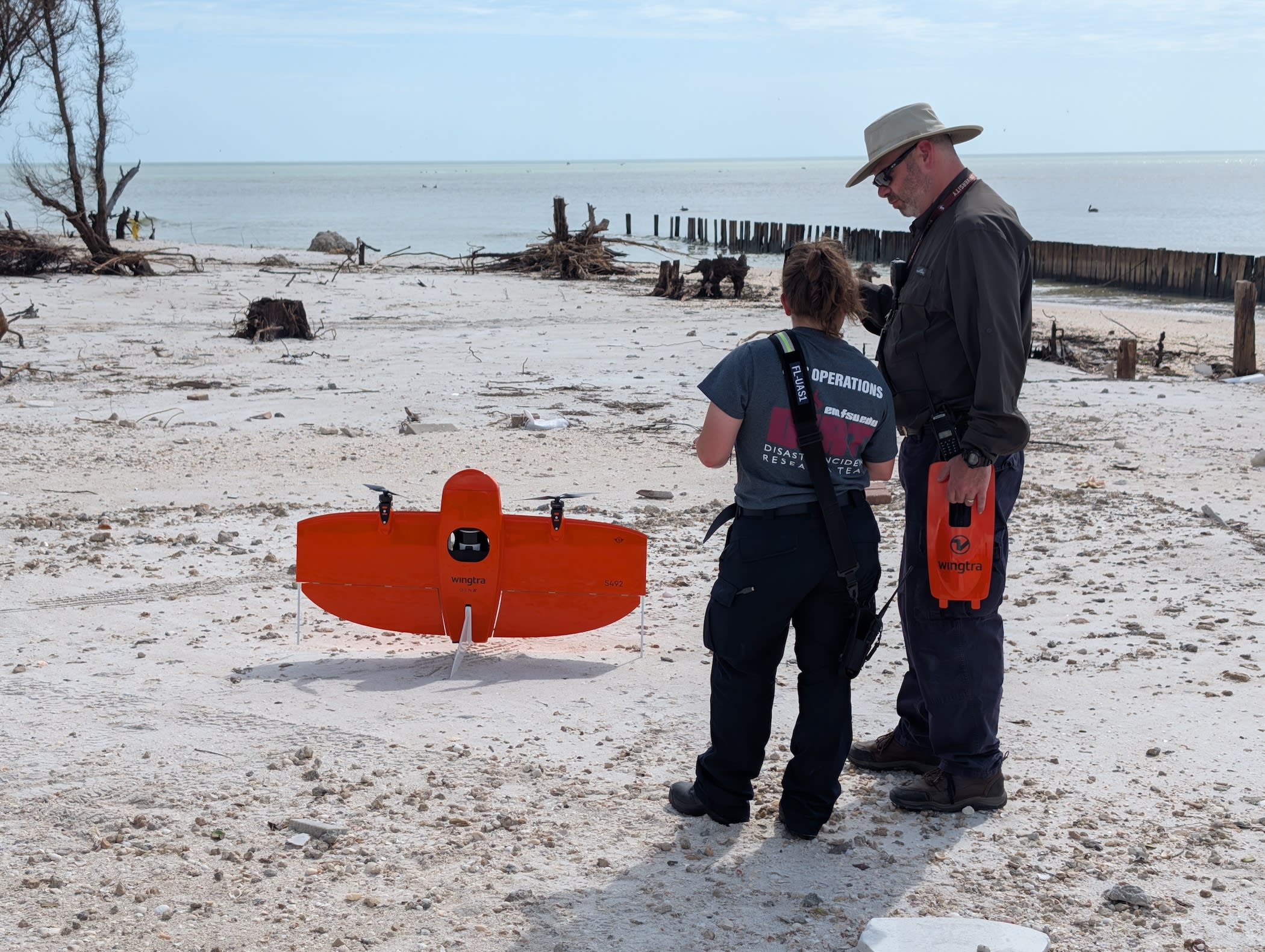
The technology leverages advances in AI-powered mapping, which collects images and then stitches them into a single image called an orthomosaic. “Our work is the use of AI machine learning for building and road damage assessment. CLARKE takes the orthomosaics to classify the damage in a matter of minutes,” said Murphy.
Murphy is a pioneer in the field of rescue robotics. Her team was the first to fly an unmanned aircraft vehicle for Hurricane Katrina and over 20 disasters since. “Most of the missions we were flying were for rapid needs assessment in areas with low cellular connectivity, so the focus was to get one big picture and a short video for tactical decision making and send it to the responders as fast as possible,” she said.
“We would fly mapping missions, usually starting day three of the disaster, for use by the strategic decision makers who wanted counts of building and road damage for planning recovery and documenting damage for state and federal cost reimbursement,” she added. The team would provide the orthomosaics, but it would take 2-3 days to get the damage counts as the images were shipped to another agency that had the time and workflow to manually classify each building and road in the aerial imagery.
As the mapping software and drones improved around 2021, mapping and low-resolution stitching became almost as fast as flying a drone manually to get the “money shot.” According to Murphy, tactical responders were then overwhelmed with images and needed a quick way to assess if “this neighborhood is nearly completely damaged” or “this area is OK except for the one area there, but the roads are totally covered with debris, so we’ll need to send in people from the north side.”
“The strategic planners were still taking days, so our goal was to leverage advances in AI/ML and create a workable system for the emergency management community,” she added.
CLARKE uses cutting-edge computer vision and machine-learning algorithms to analyze drone footage, overlay damage assessments on maps, and generate spreadsheets listing each structure’s address and damage level. For roadways, it even includes a Google Maps-style route planner that helps responders avoid impassable roads.
“This is the first AI system that can classify building and road damage from drone imagery at this scale and speed,” Murphy said. “We’re talking about assessing a neighborhood of 2,000 homes in just seven minutes. That kind of speed can save lives and resources.”
Especially in rural or hard-to-reach areas, traditional damage assessments can take days, delaying aid and complicating logistics. With CLARKE, officials could launch drones and receive a comprehensive damage report within minutes, dramatically accelerating response times.
The system was trained on drone images from over 21,000 houses across 10 major disasters, including Hurricanes Harvey and Ian. This extensive dataset allows CLARKE to recognize a wide range of damage patterns, making it adaptable to different types of disasters, including hurricanes, floods, and wildfires.
While the technology is groundbreaking, it does come with a few limitations, including training datasets and baseline models as well as trust by the emergency managers. In addition, said Murphy, “there are many technical issues that have not been encountered in satellite imagery, such as spatial misalignment of imagery, and geographical differences in imagery content.”
CLARKE has already proven its value during the 2024 hurricane season, when it was deployed in Florida and Pennsylvania following Hurricanes Debby and Helene. “We hope to continue to make progress on both the fundamental ‘under the hood’ research and the improvements to CLARKE (which is somewhere at the beta testing version, not suitable for an agency using it without us),” said Murphy.
This article was written by Chitra Sethi, Editorial Director, SAE Media Group. For more information, visit here .