42
61
169
-1
720
30
Briefs: Software
Application Program Interface for the Orion Aerodynamics Database
The Application Programming Interface (API) for the Crew Exploration Vehicle (CEV) Aerodynamic Database has been developed to provide the developers of software an easily implemented, fully self-contained method of accessing the CEV Aerodynamic Database for use in their analysis and...
Briefs: Software
Ensemble Eclipse: A Process for Prefab Development Environment for the Ensemble Project
This software simplifies the process of having to set up an Eclipse IDE programming environment for the members of the cross-NASA center project, Ensemble. It achieves this by assembling all the necessary add-ons and custom tools/preferences.
Briefs: Software
Space Operations Learning Center (SOLC) iPhone/iPad Application
This iPhone application, Space Junk Sammy, is intended to be an educational application designed for Apple iPhones and iPads. This new concept educates kids in an innovative way about how orbital debris affects space missions.
Briefs: Software
ISS Live!
International Space Station Live! (ISSLive!) is a Web application that uses a proprietary commercial technology called Lightstreamer to push data across the Internet using the standard http port (port 80). ISSLive! uses the push technology to display real-time telemetry and mission timeline data from the space station in any common Web...
Briefs: Software
Software to Compare NPP HDF5 Data Files
This software was developed for the NPOESS (National Polar-orbiting Operational Environmental Satellite System) Preparatory Project (NPP) Science Data Segment. The purpose of this software is to compare HDF5 (Hierarchical Data Format) files specific to NPP and report whether the HDF5 files are identical. If...
Briefs: Software
Test Waveform Applications for JPL STRS Operating Environment
This software demonstrates use of the JPL Space Telecommunications Radio System (STRS) Operating Environment (OE), tests APIs (application programming interfaces) presented by JPL STRS OE, and allows for basic testing of the underlying hardware platform. This software uses the JPL STRS...
Briefs: Software
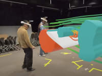
Sasquatch Footprint Tool
The Crew Exploration Vehicle Parachute Assembly System (CPAS) is the parachute system for NASA’s Orion spacecraft. The test program consists of numerous drop tests, wherein a test article rigged with parachutes is extracted or released from an aircraft. During such tests, range safety is paramount, as is the...
Briefs: Software
Galactic Cosmic Ray Event- Based Risk Model (GERM) Code
This software describes the transport and energy deposition of the passage of galactic cosmic rays in astronaut tissues during space travel, or heavy ion beams in patients in cancer therapy. Space radiation risk is a probability distribution, and time-dependent biological events must be...
Briefs: Software
Multi-User Space Link Extension (SLE) System
The Multi-User Space (MUS) Link Extension system, a software and data system, provides Space Link Extension (SLE) users with three space data transfer services in timely, complete, and offline modes as applicable according to standards defined by the Consultative Committee for Space Data Systems (CCSDS)....
Briefs: Software
Eyes on the Earth 3D
Eyes on the Earth 3D software gives scientists, and the general public, a realtime, 3D interactive means of accurately viewing the real-time locations, speed, and values of recently collected data from several of NASA’s Earth Observing Satellites using a standard Web browser (climate.nasa.gov/eyes). Anyone with Web access can...
Briefs: Information Technology
Target Trailing With Safe Navigation for Maritime Autonomous Surface Vehicles
This software implements a motion-planning module for a maritime autonomous surface vehicle (ASV). The module trails a given target while also avoiding static and dynamic surface hazards. When surface hazards are other moving boats, the motion planner must apply...
Briefs: Software
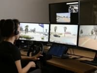
Adams-Based Rover Terramechanics and Mobility Simulator — ARTEMIS
The Mars Exploration Rovers (MERs), Spirit and Opportunity, far exceeded their original drive distance expectations and have traveled, at the time of this reporting, a combined 29 kilometers across the surface of Mars. The Rover Sequencing and Visualization Program (RSVP), the...
Briefs: Software
ISTP CDF Skeleton Editor
Basic Common Data Format (CDF) tools (e.g., cdfedit) provide no specific support for creating International Solar-Terrestrial Physics/Space Physics Data Facility (ISTP/SPDF) standard files. While it is possible for someone who is familiar with the ISTP/SPDF metadata guidelines to create compliant files using just the basic...
Briefs: Information Technology
Uplink Summary Generator (ULSGEN) Version 1.0
The Uplink Summary Generator (ULSGEN) provides a convenient means of gathering together a set of uplink related files, parsing and analyzing these files, and producing a summary of their contents, which may then be electronically signed by one or more reviewers to verify the commands. Spacecraft...
Briefs: Software
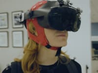
Robotics On-Board Trainer (ROBoT)
ROBoT is an on-orbit version of the ground-based Dynamics Skills Trainer (DST) that astronauts use for training on a frequent basis. This software consists of two primary software groups. The first series of components is responsible for displaying the graphical scenes. The remaining components are responsible for...
Briefs: Information Technology
Software Engineering Tools for Scientific Models
Software tools were constructed to address issues the NASA Fortran development community faces, and they were tested on real models currently in use at NASA. These proof-of-concept tools address the High-End Computing Program and the Modeling, Analysis, and Prediction Program. Two examples are the...
Briefs: Software
Automatic Data Filter Customization Using a Genetic Algorithm
This work predicts whether a retrieval algorithm will usefully determine CO2 concentration from an input spectrum of GOSAT (Greenhouse Gases Observing Satellite). This was done to eliminate needless runtime on atmospheric soundings that would never yield useful results. A space of 50...
Briefs: Software
Tracker Toolkit
This software can track multiple moving objects within a video stream simultaneously, use visual features to aid in the tracking, and initiate tracks based on object detection in a subregion. A simple programmatic interface allows plugging into larger image chain modeling suites. It extracts unique visual features for aid in...
Briefs: Information Technology
Towards Efficient Scientific Data Management Using Cloud Storage
A software prototype allows users to backup and restore data to/from both public and private cloud storage such as Amazon’s S3 and NASA’s Nebula. Unlike other off-the-shelf tools, this software ensures user data security in the cloud (through encryption), and minimizes users’...
Briefs: Software
Change-Based Satellite Monitoring Using Broad Coverage and Targetable Sensing
A generic software framework analyzes data from broad coverage sweeps or general larger areas of interest. Change detection methods are used to extract subsets of directed swath areas that intersect areas of change. These areas are prioritized and allocated to targetable...
Briefs: Software
Integrated Lunar Information Architecture for Decision Support Version 3.0 (ILIADS 3.0)
ILIADS 3.0 provides the data management capabilities to access CxP-vetted lunar data sets from the LMMP-provided Data Portal and the LMMP-provided OnMoon lunar data product server. (LMMP stands for Lunar Mapping and Modeling Project.) It also provides specific...
Briefs: Software
Relay Forward-Link File Management Services (MaROS Phase 2)
This software provides the service-level functionality to manage the delivery of files from a lander mission repository to an orbiter mission repository for eventual space-link relay by the orbiter asset on a specific communications pass. It provides further functions to deliver and track...
Briefs: Software
Two Mechanisms to Avoid Control Conflicts Resulting from Uncoordinated Intent
This software implements a real-time access control protocol that is intended to make all connected users aware of the presence of other connected users, and which of them is currently in control of the system. Here, “in control” means that a single user is authorized...
Briefs: Software
XTCE GOVSAT Tool Suite 1.0
The XTCE GOVSAT software suite contains three tools: validation, search, and reporting. The Extensible Markup Language (XML) Telemetric and Command Exchange (XTCE) GOVSAT Tool Suite is written in Java for manipulating XTCE XML files. XTCE is a Consultative Committee for Space Data Systems (CCSDS) and Object Management...
Briefs: Software
Monitoring and Acquisition Realtime System (MARS)
MARS is a graphical user interface (GUI) written in MATLAB and Java, allowing the user to configure and control the Scalable Parallel Architecture for Real-Time Acquisition and Analysis (SPARTAA) data acquisition system. SPARTAA not only acquires data, but also allows for complex algorithms to be...
Briefs: Software
Remote Data Access with IDL
A tool based on IDL (Interactive Data Language) and DAP (Data Access Protocol) has been developed for user-friendly remote data access. A difficulty for many NASA re searchers using IDL is that often the data to analyze are located remotely and are too large to transfer for local analysis. Researchers have developed a...
Briefs: Software
Gaseous Nitrogen Orifice Mass Flow Calculator
The Gaseous Nitrogen (GN2) Orifice Mass Flow Calculator was used to determine Space Shuttle Orbiter Water Spray Boiler (WSB) GN2 high-pressure tank source depletion rates for various leak scenarios, and the ability of the GN2 consumables to support cooling of Auxiliary Power Unit (APU) lubrication...
Briefs: Information Technology
Change_Detection.m
The Change_Detection.m MATLAB tool detects changes in an image by comparing the image to a background estimation. The change detection software is a MATLAB function designed to work on either a single image or a sequence of images, and computes changes with respect to a background image by one of four techniques:
Briefs: Information Technology
Ionospheric Simulation System for Satellite Observations and Global Assimilative Modeling Experiments (ISOGAME)
ISOGAME is designed and developed to assess quantitatively the impact of new observation systems on the capability of imaging and modeling the ionosphere. With ISOGAME, one can perform observation system simulation experiments (OSSEs). A...
Top Stories
 Blog: Power
My Opinion: We Need More Power Soon — Is Nuclear the Answer?
 Blog: AR/AI
Aerial Microrobots That Can Match a Bumblebee's Speed
 News: Energy
 Blog: Electronics & Computers
Turning Edible Fungi into Organic Memristors
 Blog: Robotics, Automation & Control
Microscopic Swimming Machines that Can Sense, Respond to Surroundings
 INSIDER: Sensors/Data Acquisition
Webcasts
 Upcoming Webinars: Automotive
Hydrogen Engines Are Heating Up for Heavy Duty
 Upcoming Webinars: Transportation
Advantages of Smart Power Distribution Unit Design for Automotive...
 Upcoming Webinars: Transportation
Quiet, Please: NVH Improvement Opportunities in the Early Design...
 Upcoming Webinars: Sensors/Data Acquisition
From Spreadsheets to Insights: Fast Data Analysis Without Complex...
 Upcoming Webinars: Test & Measurement
Battery Abuse Testing: Pushing to Failure