Stories
41
74
0
1170
30
Briefs: Sensors/Data Acquisition
Extensible Data Gateway Environment (EDGE)
The NASA Physical Oceanography Distributed Active Archive Center (PO.DAAC) is NASA’s designated data center for information relevant to the physical state of the ocean. Its core datamanagement and workflow system, Data Management and Archive System (DMAS), is responsible for processing hundreds of...
Briefs: Sensors/Data Acquisition
JPL CO2 Virtual Science Data Environment (VSDE)
The JPL CO2 Virtual Science Data Environment (VSDE) (http://co2.jpl.nasa.gov) is a comprehensive effort to bring together the models, data, and tools necessary for atmospheric CO2 research. The VSDE site is designed to provide streamlined Web-based discovery and access to multiple global and regional...
Briefs: Sensors/Data Acquisition
Flight Test Maneuvers for Efficient Aerodynamic Modeling
Flight testing is expensive. It is therefore important that necessary flight data be collected in the most efficient manner possible. Inputs traditionally used for flight test maneuvers to collect aircraft stability and control data include doublets, impulses (stick raps), multisteps, and...
Briefs: Sensors/Data Acquisition
Python Advanced Microwave Precipitation Radiometer Data Toolkit (PyAMPR)
Advanced Microwave Precipitation Radiometer (AMPR) brightness temperature data from NASA field projects are in ASCII format. This Python script defines a class that will read in a single file from an individual aircraft flight and pull out timing, brightness temperatures from...
Briefs: Sensors/Data Acquisition
Advanced Rapid Imaging and Analysis for Earthquakes
Advanced Rapid Imaging and Analysis for Earthquakes (ARIA-EQ) will be the first coordinated effort to automate geodetic imaging capabilities so they can be used for hazard response. The innovation is an automatic geodetic imaging data system that is the foundation for an operational hazard...
Briefs: Sensors/Data Acquisition
Data Ordering Genetic Optimization (DOGO) System
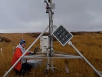
Observations in modern datasets have a continuum of quality that can be hard to quantify. For example, satellite observations are subject to often-subtle mixtures of confounding forces that distort the observation’s utility to a varying extent. For the Orbiting Carbon Observatory-2 (OCO-2)...
Briefs: Sensors/Data Acquisition
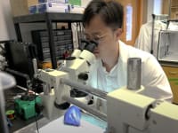
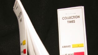
Saliva is an easily accessible body fluid containing important biological markers of physiological regulation in the body. The ability to use saliva to monitor the health and...
Briefs: Sensors/Data Acquisition
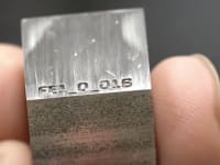
Cryogenic Propellant Feed System Analytical Tool
The Propellant Feed System Analytical Tool (PFSAT) predicts heat leak based on insulation type, installation technique, line supports, penetrations, and instrumentation. It also determines the optimum orifice diameter for an optional thermodynamic vent system (TVS) to counteract heat leak into the...
News: Imaging
Researchers from North Carolina State University and the University of Delaware have developed an algorithm that can quickly and accurately reconstruct hyperspectral images using less data. The...

INSIDER: Aerospace
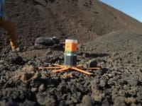
The Atacama Rover Astrobiology Drilling Studies (ARADS) project completed its first deployment after one month of field work in the hyper-arid core of the Atacama Desert in Chile, the...

INSIDER: Test & Measurement
UC Berkeley scientists released a free Android app that taps a smartphone’s ability to record ground shaking from an earthquake, with the goal of creating a worldwide seismic detection...
Articles: Sensors/Data Acquisition
GRANT MALOY SMITH President and CEO Dewetron, Inc. Wakefield, RI www.dewamerica.com
In 40 years, data acquisition products have evolved from paper-based chart recorders and analog tape...

News: Software
The most important information that is immediately needed for earthquake disasters is the location, depth, and magnitude of the earthquake. The most common method of establishing an earthquake's...

News: Software
Two new systems for driverless cars can identify a user’s location and orientation in places where GPS does not function, and identify the various components of a road scene...

News: Sensors/Data Acquisition
When astronauts return to Earth in the Orion spacecraft, they will reenter on an extremely hot and fast journey through the atmosphere before splashing down in the Pacific Ocean. To protect...

INSIDER: Transportation
For the past year, NASA’s Ames Research Center and Nissan have been collaborating on the development of autonomous driving technologies that could one day be used in future consumer vehicles,...

INSIDER: Electronics & Computers
New Tool Guides Infrastructure Recovery After Disasters
A new computerized tool guides stakeholders in preparing for, and recovering from, natural and man-made disasters such as the cyclones in India that knocked out swaths of the Indian Railways Network. The method, developed by Northeastern University researchers, guides stakeholders in the...
News: Test & Measurement
Working in collaboration with the German Aerospace Center (DLR), NASA's aeronautical innovators supplied several key instruments for the DLR's Emissions and Climate Impacts of...

News: Data Acquisition
An electronic system was developed that acquires data in real time and exchanges it across borders of systems in a standardized manner. The system makes electric vehicles more reliable and economically...

Briefs: Sensors/Data Acquisition
Convective weather systems, i.e., thunderstorms, are the leading cause of flight delay in U.S. airspace. Airline dispatchers must file their flight plans 1 to 2 hours before takeoff, and are often required to...

Briefs: Sensors/Data Acquisition
ATMS Antenna Beam Analysis Software
The Advanced Technology Microwave Sounder (ATMS) Antenna Beam Analysis Software uses a suite of test data to calculate the ATMS instrument beam pointing, and secondarily, the polarization state, in the coordinates of the onboard optical cube. The software uses measurement inputs of RF radiation pattern...
Briefs: Sensors/Data Acquisition
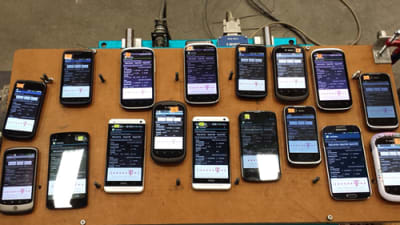
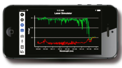
Most instruments under development rely on a traditional computer or laptop, LabVIEW software, and data acquisition (DAQ) components (which interface between the instrument and the...
Briefs: Sensors/Data Acquisition
GRAVITE Incinerator
Government Resource for Algorithm Verification, Independent Test, and Evaluation (GRAVITE) system is a National Oceanic and Atmospheric Administration (NOAA) system, developed and deployed by Joint Polar Satellite System (JPSS) Ground Project to support Calibration and Validation (Cal/Val), Data Quality Monitoring, and Algorithm...
Briefs: Sensors/Data Acquisition
GRAVITE Distribution
Government Resource for Algorithm Verification, Independent Test, and Evaluation (GRAVITE) system is a National Oceanic and Atmospheric Administration (NOAA) system, developed and deployed by Joint Polar Satellite System (JPSS) Ground Project to support Calibration and Validation (Cal/Val), Data Quality Monitoring, and...
Briefs: Sensors/Data Acquisition
GRAVITE Planner
Government Resource for Algorithm Verification, Independent Test, and Evaluation (GRAVITE) system is a National Oceanic and Atmospheric Administration (NOAA) system, developed and deployed by Joint Polar Satellite System (JPSS) Ground Project to support Calibration and Validation (Cal/Val), Data Quality Monitoring, and Algorithm...
Briefs: Sensors/Data Acquisition
GRAVITE Upload Tool
Government Resource for Algorithm Verification, Independent Test, and Evaluation (GRAVITE) system is a National Oceanic and Atmospheric Administration (NOAA) system, developed and deployed by Joint Polar Satellite System (JPSS) Ground Project to support Calibration and Validation (Cal/Val), Data Quality Monitoring, and Algorithm...
Briefs: Sensors/Data Acquisition
SMAP SDS Science Processing and Data Management System
The Science Processing and Data Management (SPDM) system’s primary functions are to control and monitor science processes and data products for Soil Moisture Active Passive (SMAP) Science Data System (SDS). SPDM adapts the Apache/OODT Framework 0.3 as the basic infrastructure. Although the...
Briefs: Sensors/Data Acquisition
Hyperlinked Overview of Piloted Evaluations (HOPE) Web- Based Data Archive
The Hyperlinked Overview of Piloted Evaluations (HOPE) application provides an interface for users to enter data on pilots, metrics, configurations, tasks, and data collection sessions, as well as descriptive information for each item and the experiment as a whole. As this...
Briefs: Sensors/Data Acquisition
GRAVITE Database
Government Resource for Algorithm Verification, Independent Test, and Evaluation (GRAVITE) system is a National Oceanic and Atmospheric Administration (NOAA) system, developed and deployed by Joint Polar Satellite System (JPSS) Ground Project to support Calibration and Validation (Cal/Val), Data Quality Monitoring, and Algorithm...
Top Stories
 Blog: Power
My Opinion: We Need More Power Soon — Is Nuclear the Answer?
 Blog: AR/AI
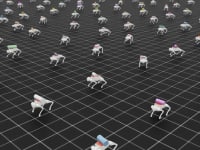
Aerial Microrobots That Can Match a Bumblebee's Speed
 News: Energy
 Blog: Electronics & Computers
Turning Edible Fungi into Organic Memristors
 Blog: Robotics, Automation & Control
Microscopic Swimming Machines that Can Sense, Respond to Surroundings
 INSIDER: Sensors/Data Acquisition
Webcasts
 Upcoming Webinars: Automotive
Hydrogen Engines Are Heating Up for Heavy Duty
 Upcoming Webinars: Transportation
Advantages of Smart Power Distribution Unit Design for Automotive...
 Upcoming Webinars: Transportation
Quiet, Please: NVH Improvement Opportunities in the Early Design...
 Upcoming Webinars: Sensors/Data Acquisition
From Spreadsheets to Insights: Fast Data Analysis Without Complex...
 Upcoming Webinars: Test & Measurement
Battery Abuse Testing: Pushing to Failure