
An automated procedure has been developed to derive relevant factors, which can increase the ability to produce objective, repeatable methods for determining aerodynamic surface roughness. Aerodynamic surface roughness is used for many applications, like atmospheric dispersive models and wind-damage models. For this technique, existing lidar data was used that was originally collected for terrain analysis, and demonstrated that surface roughness values can be automatically derived, and then subsequently utilized in disaster-management and homeland-security models.
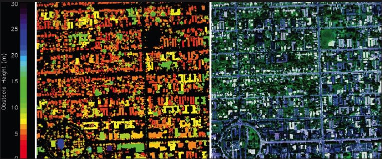
In its current state, the algorithm calculates an estimated surface roughness for a square kilometer area; techniques using the lidar data to calculate the surface roughness for a “point,” whereby only roughness elements that are upstream from the point of interest are used and the wind direction is a vital concern, are being investigated. This technological advancement will improve the reliability and accuracy of models that use and incorporate surface roughness.
This work was done by Donald Holland of Science Systems and Applications, Inc., for Stennis Space Center.
Inquiries concerning this technology should be addressed to the Intellectual Property Manager, Stennis Space Center, 228-688- 1929. Refer to SSC-00296-1, volume and number of this NASA Tech Briefs issue, and the page number.