Stories
41
80
0
2190
30
Products: Sensors/Data Acquisition
The new Komfy™ Switch with camera by D-Link features the iAQcore indoor air quality module from ams (Cupertino, CA). The iAQcore, a miniaturized, low-power gas sensor, uses a MEMS-based VOC component. The device provides an...

Products: Sensors/Data Acquisition
OmniVision Technologies (Santa Clara, CA) has released the OV16860, a 16-megapixel PureCel® Plus-S image sensor. A 1.3-micron pixel architecture enables full resolution recording at 45 frames per second. The sensor also supports...

Products: Sensors/Data Acquisition
TE Connectivity (Berwyn, PA) has announced the 86BC, a 16-mm piezoresistive silicon pressure sensor packaged in a 316L stainless steel housing. O-ring mounting supports integration into industrial applications. The header-less...

Products: Sensors/Data Acquisition
WAGO Corp. (Germantown, WI) has added 3-Phase Power Measurement Modules to its XTR line of harsh environment (-40 °C to 70 °C extreme temperature and 5g vibration resistance) I/O. Varying communication interfaces...

Products: Sensors/Data Acquisition
The POSIWIRE® WS21 cable extension sensor from ASM (Elmhurst, IL) is equipped with a non-contact, magnetic multi-turn-encoder that enables long measuring lengths up to 20,000 mm. Typical applications include linear...

Products: Sensors/Data Acquisition
Exergen Corp. (Watertown, MA) has announced the Extreme IRt/c non-contact temperature sensor. A custom-designed housing protects the sensor from extreme vibrations, shifts in pressure, and other acute ambient changes. The...

Products: Sensors/Data Acquisition
Macro Sensors (Pennsauken, NJ) has introduced submersible LVDT Position Sensors for use as part of subsea measurement systems. The SSIR 937 Series Submersible LVDT Position Sensors withstand deep sea environments...

Products: Sensors/Data Acquisition
Pressure Profile Systems (Los Angeles, CA) has released the SingleTact, a miniature capacitive force sensor. The ultra-thin, single-element device quantifies forces in analog or digital configuration. The SingleTact...
INSIDER: Energy
Biological systems are known to convert energy generated from the evaporation of water confined within nanoscale compartments into muscle-like mechanical work in response to changes in...
INSIDER: Automotive
For the past year, NASA’s Ames Research Center and Nissan have been collaborating on the development of autonomous driving technologies that could one day be used in future consumer vehicles,...

Briefs: Sensors/Data Acquisition
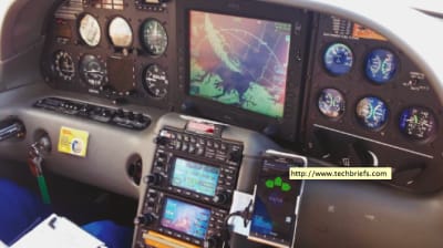
Controlled flight into terrain (CFIT) causes almost 100 deaths each year in the United States. Although warning systems have virtually eliminated CFIT for large...
Briefs: Sensors/Data Acquisition
New technology combines the benefits of non-contact linear position sensing with the programmability of a programmable controller in a relatively small sensor package. This...
Briefs: Sensors/Data Acquisition
For a number of applications, the pointing direction towards the Sun must be known or measured. Con ventional Sun sensors determine the pointing direction towards the Sun while the Sun is in the field of view of the...

Briefs: Sensors/Data Acquisition
A conventional Sun sensor determines the orientation of the Sun in two axes. If mounted on Earth in a known coordinate system, it can determine the azimuth and elevation of the Sun. When mounted...

Briefs: Sensors/Data Acquisition
Venus Heat Flux Sensor
A sensor element that consists of a thermally resistive layer made of nand p-type semiconductor elements amplifies the temperature gradient in the resistive layer that results from heat flow through the sensor. The thermoelectric array provides greater accuracy and sensitivity over a traditional thermopile arrangement for...
Briefs: Sensors/Data Acquisition
Radio frequency identification (RFID) tags consist of an antenna and an integrated circuit. The antenna is typically the more costly of the two components, and, by far, the largest. As antenna size...
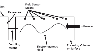
Briefs: Sensors/Data Acquisition
Sensor Planning Service for Submitting Requests to Task the EO-1
A Web interface framework has been developed that implements the Open Geospatial Consortium (OGC) Sensor Planning Service (SPS) specification. The OGC defines the SPS to “provide information concerning content and encoding of the parameter data that has to be provided in order to...
Briefs: Sensors/Data Acquisition
Transparent and Ubiquitous Sensing Technology
Traditionally, sensor systems are considered independent systems that are separately designed, manufactured, and integrated into a target system such as an aircraft. In most cases, this is a complex and costly process including sensor design, installation, wiring, testing, and maintenance. The sensor...
Briefs: Sensors/Data Acquisition
Position Sensing and Formation Flying Using Optical Beacons
One way of imaging exoplanets around nearby stars is to use a starshade in conjunction with a space telescope. Typically, the starshade, which resembles a sunflower in outline, is ~ 30 meters in diameter. The starshade is flown about 50,000 km in front of the telescope, and when positioned...
Briefs: Sensors/Data Acquisition
Multiple-Frequency-Band Software-Defined Radiometer
Remote sensing — the use of spacebased satellite technologies to obtain information on environmental variables — in combination with other types of data, can provide information on changes in the Earth’s surface and atmosphere that are critical for weather forecasting and responding to human...
INSIDER: Energy
Scientists from Stanford University have discovered how to make the electrical wiring on top of solar cells nearly invisible to incoming light. The new design, which uses silicon nanopillars to...

Briefs: Data Acquisition
GRAVITE Pull Server
Government Resource for Algorithm Verification, Independent Test, and Evaluation (GRAVITE) system is a National Oceanic and Atmospheric Administration (NOAA) system, developed and deployed by Joint Polar Satellite System (JPSS) Ground Project to support Calibration and Validation (Cal/Val), Data Quality Monitoring, and Algorithm...
Articles: Unmanned Systems
A new imaging sensor created by a team at Carnegie Mellon University and the University of Toronto allows depth cameras to operate effectively in bright sunlight. The researchers, including Srinivasa...

Articles: RF & Microwave Electronics
The field of wireless vital sign monitoring has a relatively long history, almost as long as radar itself. Doppler radar has been the primary sensor technology for detecting blood flow or...

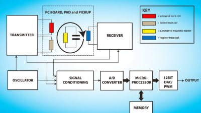
Articles: Sensors/Data Acquisition
Successful magnetic circuits are built upon proper planning and design principles. Experienced design engineers take a holistic approach to the design process by considering the full...

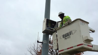
Application Briefs: Sensors/Data Acquisition
In an effort to improve traffic flow, driver safety, and asset management, the Michigan Department of Transportation (DOT) has installed 17 sensors on a 50-mile stretch of...
Products: Sensors/Data Acquisition
The new Revolution series of q-switched, green, pulsed lasers from Coherent, Inc. (Santa Clara, CA) provides average power up to 80W at a wavelength of 527 nm, with a beam profile featuring an extremely smooth energy...

Products: Manufacturing & Prototyping
New Avionics Corp (Ft. Lauderdale, FL) has announced its Ice*Meister™ Model 9732-PLASTIC Ice Detecting Sensor for Aircraft. The unit consists of a probe, housing, circuit board, and lightweight blue cable. The product, tested at...

Products: Sensors/Data Acquisition
STMicroelectronics (Geneva, Switzerland) has introduced two central airbag crash sensors. The AIS1120SX and AIS2120SX single- and dual-axis 120g in-plane MEMS accelerometers are designed to be mounted in the vehicle’s...

Top Stories
 Blog: Power
My Opinion: We Need More Power Soon — Is Nuclear the Answer?
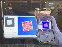
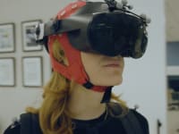
 Blog: AR/AI
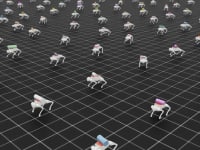
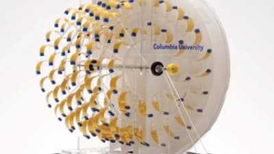
Aerial Microrobots That Can Match a Bumblebee's Speed
 News: Energy
 Blog: Electronics & Computers
Turning Edible Fungi into Organic Memristors
 Blog: Robotics, Automation & Control
Microscopic Swimming Machines that Can Sense, Respond to Surroundings
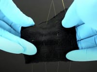
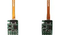
 INSIDER: Sensors/Data Acquisition
Webcasts
 Upcoming Webinars: Energy
Hydrogen Engines Are Heating Up for Heavy Duty
 Upcoming Webinars: Transportation
Advantages of Smart Power Distribution Unit Design for Automotive...
 Upcoming Webinars: Automotive
Quiet, Please: NVH Improvement Opportunities in the Early Design...
 Upcoming Webinars: Test & Measurement
From Spreadsheets to Insights: Fast Data Analysis Without Complex...
 Upcoming Webinars: Power
Battery Abuse Testing: Pushing to Failure