Top Stories
 Blog: Lighting
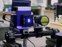
A Stretchable OLED that Can Maintain Most of Its Luminescence
 Blog: Energy
Batteries that Can Withstand the Cold
 INSIDER: Energy
Advancing All-Solid-State Batteries
 Quiz: Energy
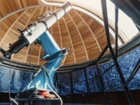
 Blog: Physical Sciences
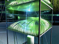
 Blog: Materials
Webcasts
 Upcoming Webinars: Test & Measurement
From Spreadsheets to Insights: Fast Data Analysis Without Complex...
 Upcoming Webinars: Electronics & Computers
Cooling a New Generation of Aerospace and Defense Embedded...
 Upcoming Webinars: Test & Measurement
Beyond AI-Copy-Paste Engineering: Advanced AI-Integration Success...
 Upcoming Webinars: Automotive
Battery Abuse Testing: Pushing to Failure
 Upcoming Webinars: Internet of Things
A FREE Two-Day Event Dedicated to Connected Mobility
 Upcoming Webinars: Test & Measurement
Choosing the Right N-Port Strategy: Multiport VNAs vs. Switch...